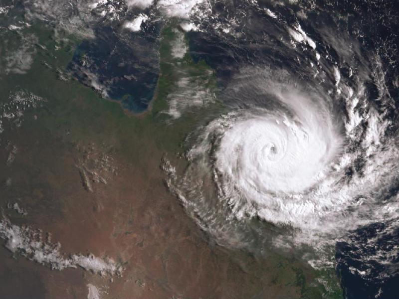
Cyclones are a part of life for people living in Queensland’s coastal areas.
Queensland’s cyclone season officially runs from 1 November to 30 April, however cyclones can occur at other times. It’s important that households and their communities are prepared year-round. Communities within 50 kilometres of the coastline from Bundaberg to Thursday Island, including the Gulf of Carpentaria are most susceptible to cyclones. However, accompanying wind and heavy rain from weakening cyclones can affect communities throughout all parts of Queensland.
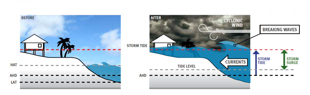
What is a cyclone, storm surge and storm tide?
The Bureau of Meteorology provides the following explanations to explain how cyclones, storm surges and storm tides work hand in hand to create at times catastrophic conditions.
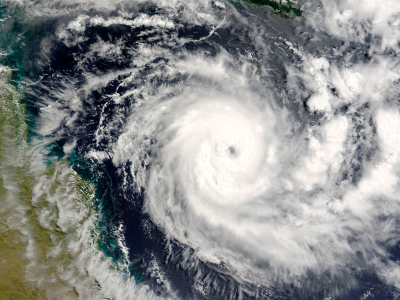
Understanding tropical cyclones
The severity of cyclones are expressed as categories one to five. Laura Boekel of the Bureau of Meteorology explains the preparation for cyclones, the categories and what can occur after a cyclone.

Category wind gusts (km/h) and typical impact
| Category | Strongest Gust | Typical effects |
|---|---|---|
| 1 - Tropical Cyclone | Less than 125 km/h Gales | Minimal house damage. Damage to some crops, trees and caravans. Boats may drag moorings. |
| 2 - Tropical Cyclone | 126-164 km/h Destructive winds | Minor house damage. Significant damage to signs, trees and caravans. Heavy damage to some crops. Risk of power failure. Small boats may break moorings. |
| 3 - Severe Tropical Cyclone | 165-224 km/h Very destructive winds | Some roof and structural damage. Some caravans destroyed. Power failure likely. |
| 4 - Severe Tropical Cyclone | 225-279 km/h Very destructive winds | Significant roofing and structural damage. Many caravans destroyed and blown away. Dangerous airborne debris. Widespread power failures. |
| 5 - Severe Tropical Cyclone | More than 280 km/h Extremely destructive winds | Extremely dangerous with widespread destruction. |
Know your risk
Queensland homes within 50 kilometres of the coastline north from Bundaberg need to be strong enough to withstand cyclonic winds.
Wind loading regions
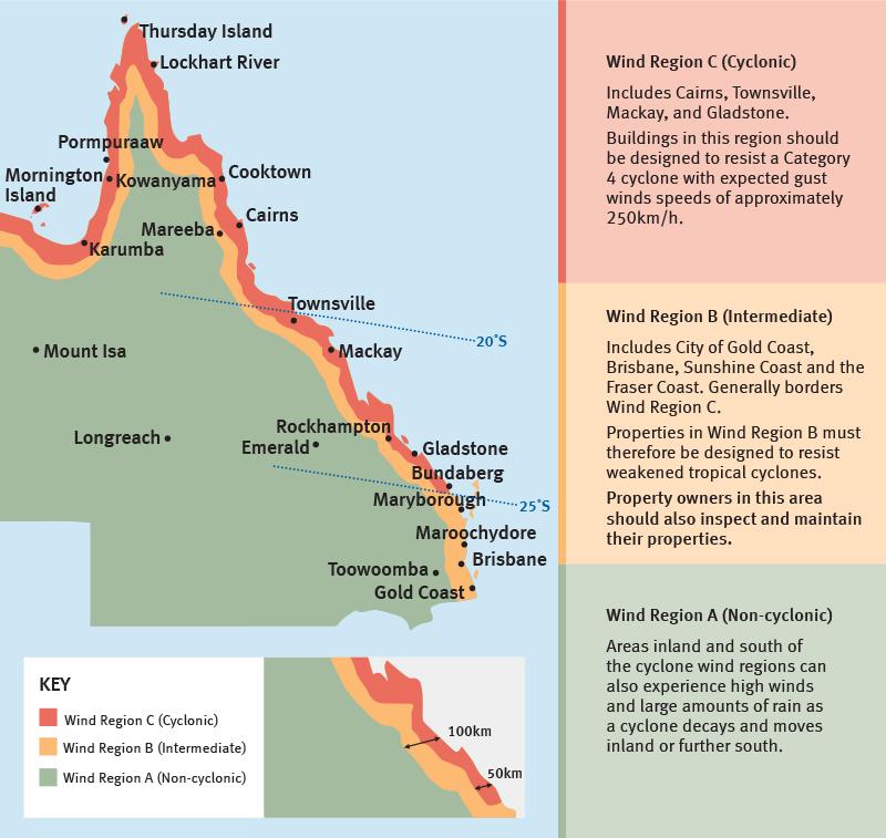
Data from: Australian Institute for Disaster Resilience
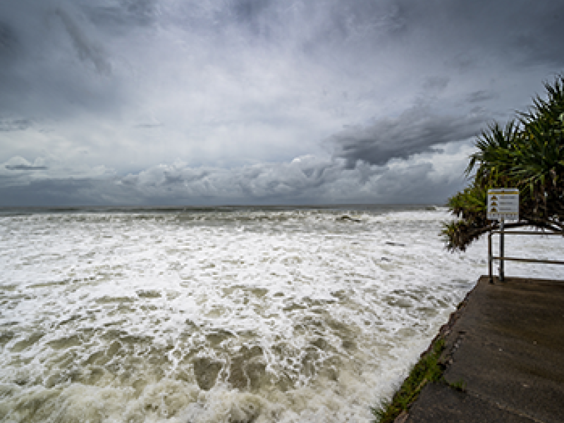
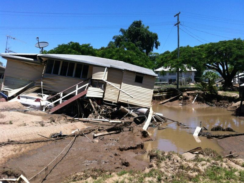
In addition, homes located within 100 to 200 metres of an open shoreline are at risk of impacts from breaking waves caused by storm tide.
To understand your storm tide risk, you can request a Coastal Hazard Property Map which shows the estimated storm tide levels for your particular property. You can also talk to a coastal engineer who can confirm whether your property is likely to be impacted by waves during a storm tide.
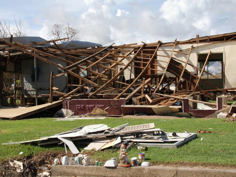
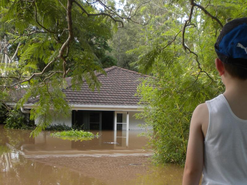
What happens in a cyclone?
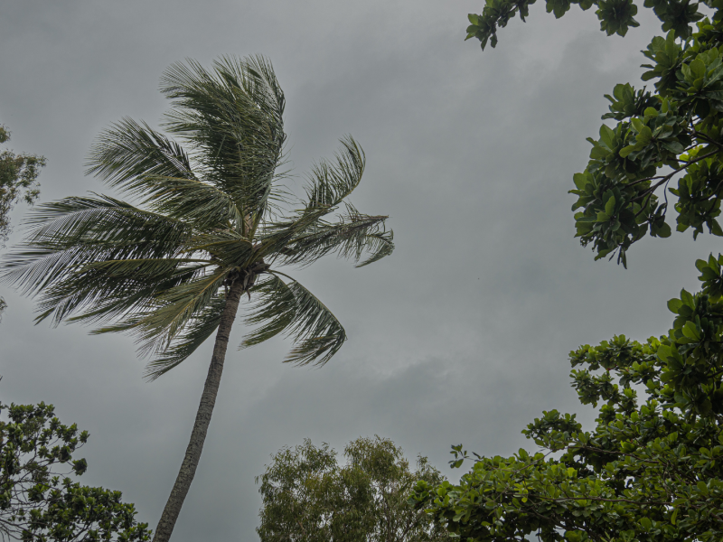
As a cyclone approaches, the wind and rain gradually increases over several hours.
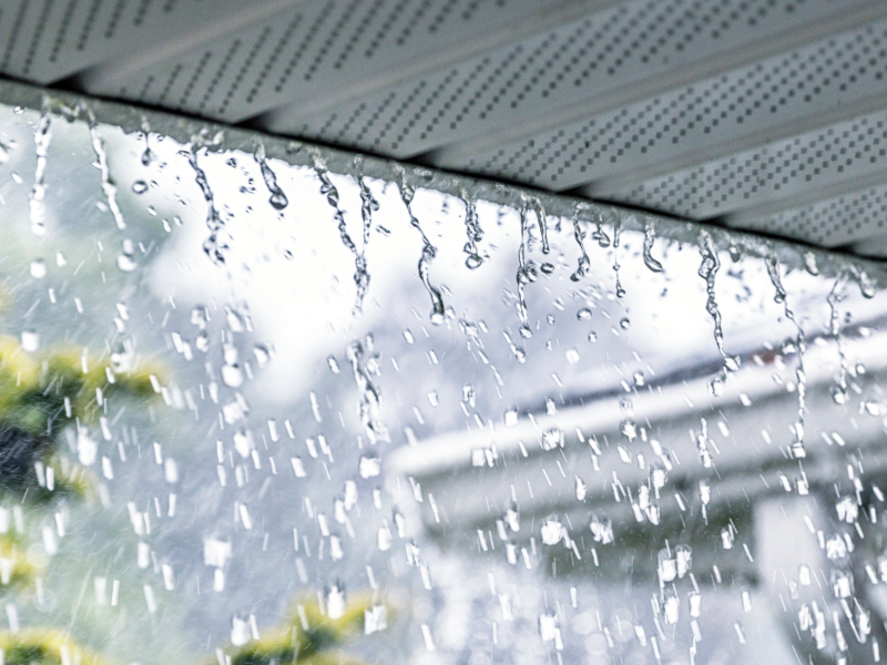
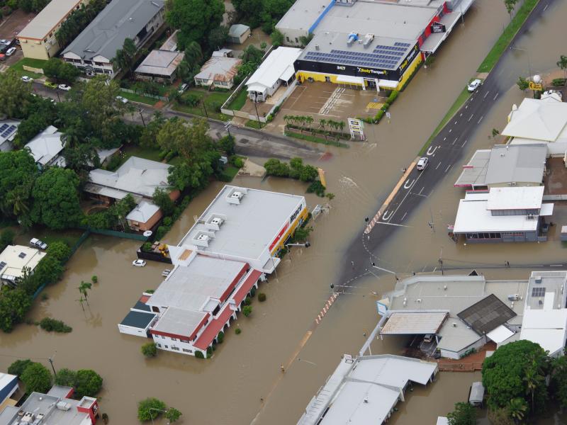
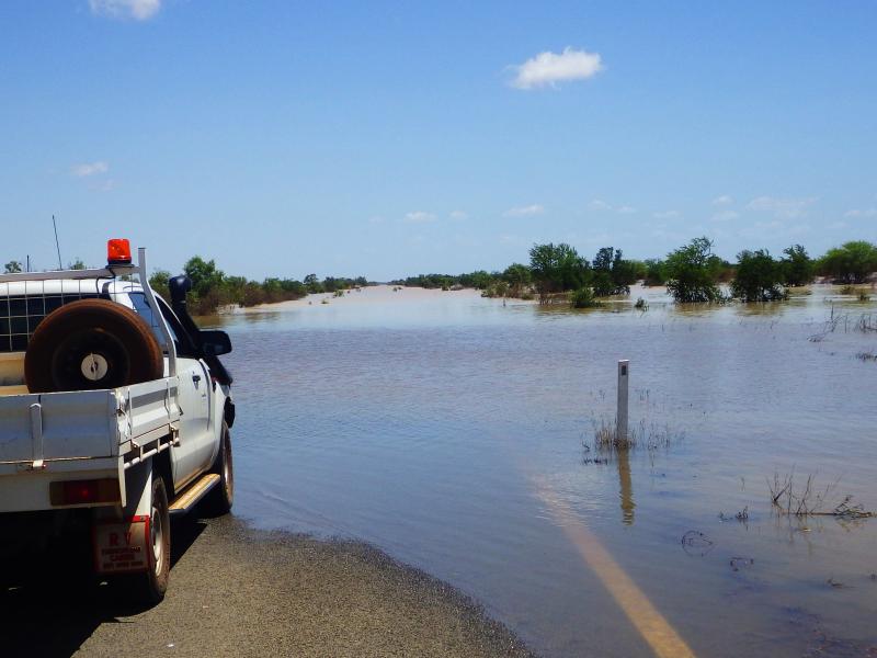
A cyclone will sound like a roaring train or jet engine and skies will darken, turning the day into night. You could be inside for many hours. There may be strong winds and horizontal rain. These winds are powerful enough to break large trees, roll over sea containers, and blow away unsecured caravans, garden sheds and poorly constructed roofed patios. They can cause extensive property damage and turn loose items into wind-borne debris that cause further building damage. Slow moving cyclones can take many hours to move past a particular location, and extreme wind and rain can last up to 12 hours.
As the cyclone moves over the coastline, those in the direct path will experience the eye of the cyclone, and it's lighter winds and clear skies. The eye can be from 10km - 100km wide. When the eye passes over, the returning winds are faster, more intense and can return without any warning.


Find out more and Get Ready
Check out these other pages and resources to help you Get Ready.